


 Download(10.28MB)
 13.1.0 (Play)
 103.16MB
7
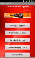
Check Stations, Maps, FARES, Schedules of Service, Among Others.
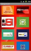
Application that shows the most used means of transport in Mexico City, such as Metro, Metrobus, Suburban Train and Light Rail, in addition to Ecobici, Pumabus, Turibus and Trolebus circuits.
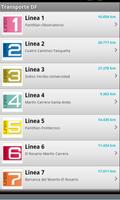
You can consult the general maps and by line, location of map stations, service rates, service schedules, among others, distance consultation between the station and your location when clicking on the location icon of the station, also includes maps in high resolution of the Turibus circuits, and information of the Trolebus means.
You can install the application in the external memory of your device
More means of transport will be added.
 Similarity
April 4, 2026
April 4, 2026
April 4, 2026
April 4, 2026
April 3, 2026
April 3, 2026
April 3, 2026
April 3, 2026
April 3, 2026
April 3, 2026
April 2, 2026
April 2, 2026