


 Download(89.53MB)
 1.02
1.02
 13.53MB
7.7
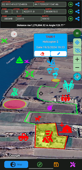
Map application for off-road activities
Features;
- Map for off-road activities
- Multiple coordinate types(UTM, MGRS, LAT LONG)
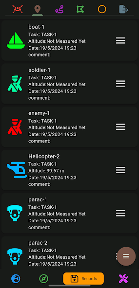
- Operation/Activity planning
- Sharing scheduled recordings
- Export scheduled recordings
- Import scheduled recordings
- Compass feature
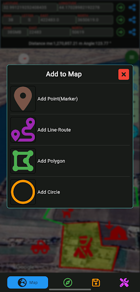
- Adding a marker to the map (with color, image and size options)
- Designing Lines/Routes
- Design areas (with frame and fill color options)
- Design circles (with frame and fill color options)
- Automatic route recording creation
- Progress at the specified distance at the specified angle
-Live location tracking
 Similarity
April 3, 2026
April 3, 2026
April 3, 2026
April 3, 2026
April 3, 2026
April 3, 2026
April 2, 2026
April 2, 2026
April 2, 2026
April 2, 2026
April 2, 2026
April 2, 2026